Slide One
BECOME A BEACH SCIENTIST
Download the CoastSnap App and get snapping
Slide One
Slide One
Observe your coastline
Help to study climate change and its effects
Slide One
Slide Two
Your beach can tell stories
Get the CoastSnap App and start spotting
Slide Two
Slide Three
Understanding climate change

Help research with your contributions

Slide Three
previous arrow
next arrow

Data overview

Instructions to bulk download CoastSnap image data for a single location can be viewed here.

CoastSnap is a global citizen science project to capture our changing coastlines. No matter where you are in the world, if you have a smartphone and an interest in the coast, we welcome you to participate! CoastSnap relies on repeat photos at the same location to track how the coast is changing over time due to processes such as storms, rising sea levels, human activities and other factors. Using a specialised technique known as photogrammetry, CoastSnap turns your photos into valuable coastal data that is used by coastal scientists to understand and forecast how coastlines might change in the coming decades. Photogrammetry enables the position of the coastline to be pinpointed from your snaps to an accuracy similar to that of professional coastal survey teams. All we ask is that you take the photos at the same location (by using one of our official CoastSnap camera cradles or a do-it-yourself adaptation) and record the precise photo time in the App. The more photos we have of a particular site, the better our understanding becomes of how that coastline is changing over time.
  The data of the project can be downloaded for free. For technical reasons, a user account is needed. You are not obliged to collect data yourself to be able to download the data. The following steps can be carried out here. For questions, send an e-mail to This email address is being protected from spambots. You need JavaScript enabled to view it.. Click on “Login” to login or register. If you already have an account for a citizen science project on the Spotteron platform, you can use this account to login.   On the map, navigate to your spot of interest. Click on the spot and you will see the last observation. Open the options by clicking on the three vertical dots.   Choose the option “Create Spot-Package” and confirm the download.The data of the spot (as a csv) and all images belonging to the spot get downloaded now.
Browse the map for reports in the project!
Project information Project name:   CoastSnap Responsible for the project:   School of Civil and Environmental Engineering UNSW Sydney, Water Research Laboratory 110 King St, Manly Vale NSW 2093, Australia Project partners:   CoastSnap Research Network  UNSW Sydney + NSW Government (initial project founders) Project platform:   SPOTTERON GmbHCitizen Science Platformwww.spotteron.net Purpose of data processing of the app:   Saving and display of observations by users in apps and interactive maps Scientific analysis Anonymization and submitting of anonymized content to CoastSnap Research Network Data protection officers of project partners:   UNSW Sydney Contact:   This email address is being protected from spambots. You need JavaScript enabled to view it. Locations of Data Savings:   • SPOTTERON Server Cloud (AWS: European Servers)• Coastsnap Research Network Servers
Privacy Policy Last updated: October 20, 2020 This Privacy Policy describes Our policies and procedures on the collection, use and disclosure of Your information when You use the Service and tells You about Your privacy rights and how the law protects You. We use Your Personal data to provide and improve the Service. By using the Service, You agree to the collection and use of information in accordance with this Privacy Policy. This Privacy Policy has been created with the help of the Privacy Policy Generator. Interpretation and Definitions Interpretation The words of which the initial letter is capitalized have meanings defined under the following conditions. The following definitions shall have the same meaning regardless of whether they appear in singular or in plural. Definitions For the purposes of this Privacy Policy: Account means a unique account created for You to access our Service or parts of our Service. Company (referred to as either "the Company", "We", "Us" or "Our" in this Agreement) refers to School of Civil and Environmental Engineering UNSW Sydney, Water Research Laboratory, 110 King St, Manly Vale NSW 2093, Australia. Cookies are small files that are placed on Your computer, mobile device or any other device by a website, containing the details of Your browsing history on that website among its many uses. Country refers to: New South Wales, Australia Device means any device that can access the Service such as a computer, a cellphone or a digital tablet. Personal Data is any information that relates to an identified or identifiable individual. Service refers to the Website. Service Provider means any natural or legal person who processes the data on behalf of the Company. It refers to third-party companies or individuals employed by the Company to facilitate the Service, to provide the Service on behalf of the Company, to perform services related to the Service or to assist the Company in analyzing how the Service is used. Third-party Social Media Service refers to any website or any social network website through which a User can log in or create an account to use the Service. Usage Data refers to data collected automatically, either generated by the use of the Service or from the Service infrastructure itself (for example, the duration of a page visit). Website refers to CoastSnap, accessible from https://www.coastsnap.com You means the individual accessing or using the Service, or the company, or other legal entity on behalf of which such individual is accessing or using the Service, as applicable. Collecting and Using Your Personal Data Types of Data Collected Personal Data While using Our Service, We may ask You to provide Us with certain personally identifiable information that can be used to contact or identify You. Personally identifiable information may include, but is not limited to: Usage Data Usage Data Usage Data is collected automatically when using the Service. Usage Data may include information such as Your Device's Internet Protocol address (e.g. IP address), browser type, browser version, the pages of our Service that…
app manuakl asdsad how to d asd sadsa
If you want to get in contact please use this information: UNSW Sydney: This email address is being protected from spambots. You need JavaScript enabled to view it.  
Please see the drop down menus above for various options to download CoastSnap data  
For a general overview of the CoastSnap project, please refer to the following publication that was published in a special issue on community outreach initiatives in the scientific journal Continental Shelf Research: Harley, M.D. and Kinsela, M. (2022) CoastSnap: A global citizen science program to monitor changing coastlines, Continental Shelf Research, 245, 104795, https://doi.org/10.1016/j.csr.2022.104796 For more specific technical details about how CoastSnap images can be used by scientists and engineers to map shoreline change, please refer to: Harley, M.D., Kinsela, M., Sánchez-García, E. and Vos, K. (2019) Shoreline change mapping using crowd-sourced smartphone images, Coastal Engineering, 150, 175-189, https://doi:10.1016/j.coastaleng.2019.04.003

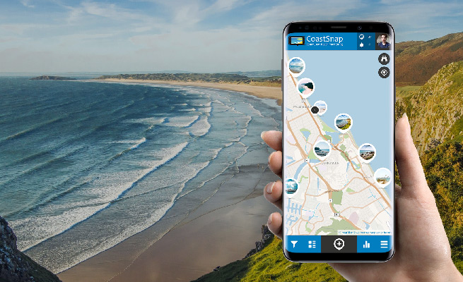
CoastSnap smartphone app with coast background

Step 1: Citizen Science App Download

Download

Get the free Citizen Science App on Google Play for Android or in the Apple App Store.
Step 2: Register your SPOTTERON Citizen Science user account

Register

After the start of the app, you can register your own user account with just your eMail address.
Step 3: Login and contribute in the Citizen Science App

Start!

Start observing! You are automatically logged-in after registering to add your first observation.


Download the App on your smartphone now or open the map in your browser:

 Badge App Download Android Badge App Download iPhone Open map

Check out the latest CoastSnaps

CoastSnap, Anonymous
15/05/2024

StCyrusdfs
15/05/2024

StCyrusdfs
15/05/2024

CoastSnap, Anonymous
15/05/2024

CoastSnap, Anonymous
15/05/2024

CoastSnap, Anonymous
15/05/2024

CoastSnap, Anonymous
15/05/2024

RonG1
14/05/2024

Justine17
15/05/2024

Justine17
14/05/2024


See more Spots on the map


LandscapeColourNeg

News

  • We have reached 40,000 CoastSnaps! Thank you to everyone for your ongoing participation in helping to track changing coastlines!

  • Welcome to the new CostSnap Citizen Science project website! Check out our new CoastSnap app! We have partnered with CitizenScience company SPOTTERON to bring you a new and exciting way to monitor coastline change around the world