Welcome to the Port Phillip Bay CoastSnap Network!
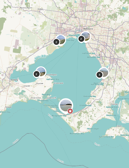
The University of Melbourne is working with stakeholders around Port Phillip Bay to establish a community monitoring network around the shores of our region. We have installed 10 CoastSnap monitoring stations in locations around the bay, to enable community members to capture how our dynamic world is changing over time using their smartphones. These stations are located at Sandridge, Red Bluff, Carrum Beach, Rye Beach, Altona Beach, Werribee South, Clifton Beach, Ramblers Rd Beach, Frankston Beach and Seaford Beach.
Participating in this program is a snap - all you need to do is download the CoastSnap App (available from Apple and Android App Stores) and visit one of the CoastSnap locations. Each one has a camera cradle, specifically designed to control the position of your photo. By using something called Photogrammetry, scientists can use your photos to make maps at an accuracy similar to that of professional survey team. As more and more photos are taken, your snaps provide a powerful record to enable researchers to understand how our coastline is changing due to processes such as storm surges, sea level rise and human factors.
The more photos we have of a particular location, the better our understanding becomes of how environments, such as coastlines, are changing over time, and thus helping communities, local government and stakeholders to better manage these valuable environments.
Your snaps form part of the global network of CoastSnap stations with over 200 stations worldwide. Simply put your smartphone in the camera cradle and take a snap, it's that easy!

Check out the latest CoastSnaps provided by our community scientists at the ten monitoring stations around Port Phillip Bay! If you wish to browse the complete record of snaps at each site, simply click on one of the snaps and it will take you to the CoastSnap map.
Check out the latest timelapse movies provided by our community scientists at the ten monitoring stations around Port Phillip Bay!