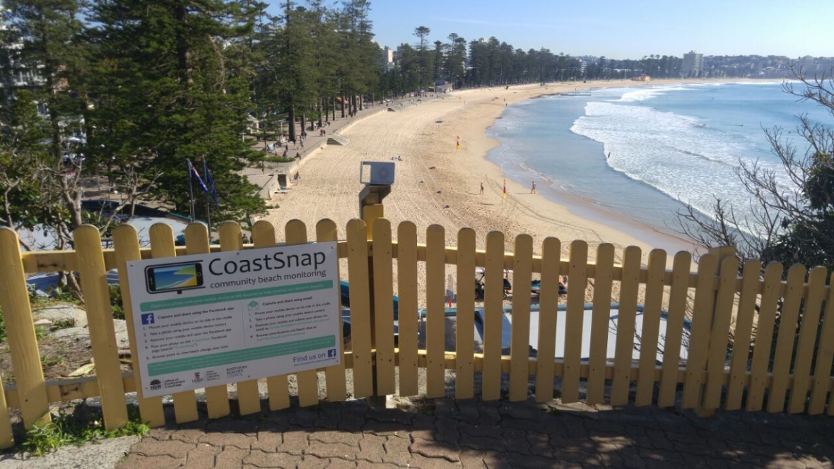
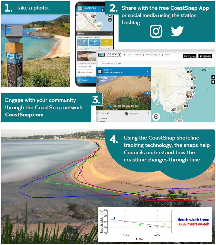
How it works
At the heart of CoastSnap is a simple stainless steel phone cradle that is installed overlooking a beach in a location that is easily accessible by the community. Using the instructional sign a beach visitor is encouraged to place their phone into the cradle, take a photo, and share it to a centralised database via the free CoastSnap App or social media using a QR code and hashtag unique to each station. This collection of community led images will provide a record of the coastline as it evolves. The technology behind CoastSnap is then capable of creating time-lapse videos and tracking the precise changes in the position of the coastline over time.
Check out the following video to find out more about the CoastSnap technology.