Welcome to the Douglas Shire CoastSnap Network!
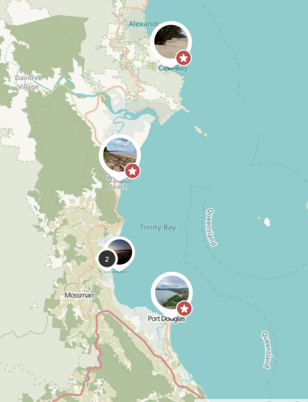
Welcome to the Douglas Shire CoastSnap community beach monitoring network. We have installed five CoastSnap beach monitoring stations in Douglas Shire to allow the community to record changes to our precious coastline. These stations are located at Cow Bay, Newell Beach, Cooya Beach, Wonga Beach, and Four Mile Beach.
Participating in this program is a snap - all you need to do is download the CoastSnap App (available from Apple and Android App Stores) and visit one of these five stations. The unique camera cradles are specifically designed to control the position of your photo. As more and more photos are taken, your snaps provide a powerful record to enable researchers to understand how our coastline is changing due to processes such as cyclones and storm surges, sea-level rise and human factors. Simply put your smartphone in the camera cradle and take a snap, it's that easy!
What's more, your snaps form part of the global network of CoastSnap stations with over 100 stations worldwide. We thank the community for their involvement and happy (coast)snapping!

Check out the latest CoastSnaps provided by our community scientists at the five monitoring stations in Douglas Shire! If you wish to browse the complete record of snaps at each site, simply click on one of the snaps and it will take you to the CoastSnap map.
Check out the latest timelapse movies provided by our community scientists at the five monitoring stations in Douglas Shire!